

 Program Name: Mapped_Vis
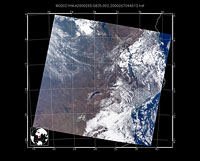
Program Description: This package consists of a PERL script which controls the usage of a set of IDL visualization codes designed to plot, with geolocated projection, individual granules of Level 1B and various Level 2 Atmosphere products. These codes were originally designed as aides in diagnosing the MOD06 cloud optical properties products, and as such parameters of interest to this effort are plotted. However, these codes can easily be modified to plot other parameters of interest. The current version contains IDL codes to generate granule level images of surface albedo, ecosystem, Level 1B true color composite, Cloud Mask bit flags, Level 2 MOD06 QA bit flags, ancillary data (only with the intermediate MOD06 ancillary HDF file) and parameters, and MOD06 Level 2 images with separate color schemes for ice and water phases.
Language and Environment Requirements: IDL, PERL
Limitations: Requires that IDL have read access to the input HDF file and write access to the output file location. The code was tested using IDL version 5.2, more recent versions of IDL have not been tested and results can not be guaranteed.
Installation Tips: Download and uncompress the tar.gz file below. Once the files are unzipped and untarred, examine the README.txt file for more details on running the code.
Developer: Eric Moody (NASA GSFC)
Current Version: Version 1.0 (2001)
Download:
Note: Download file is zipped and tarred.
To Unzip use the command "gzip -d filename".
To UnTar use the command "tar -xvf filename".