

 Water Vapor Product (05_L2) File Format Basics
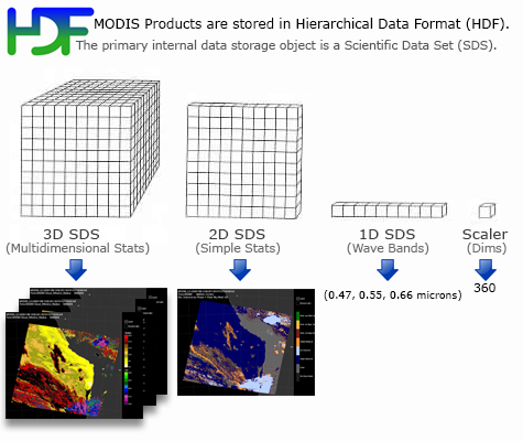
Water Vapor (05_L2) Product files are stored in Hierarchical Data Format (HDF). HDF is a multi-object file format for sharing scientific data in multi-platform distributed environments. HDF files should only be accessed through HDF library subroutine and function calls, which can be downloaded from the HDF web site. Each of the parameters listed below is stored as a Scientific Data Set (SDS) within the HDF file.
The values stored in the SDS (other then the geolocation arrays) are short integer values in order to save storage space. To calculate the real data value, the scale_factor and the add_offset are needed to apply to the stored value. These are local attributes attached to each SDS. The following equation should be used to get to the real value:
value = scale_factor * ( stored_value - add_offset )
Regarding to the quality assurance of the Water_Vapor_Infrared (07_L2) products copied into the 05_L2 file, there are either have sufficient data (e.g. at least 5 out of 25 pixels defined as confident clear) and the "Best Quality Data" retrievals are produced or the retrievals are flagged missing. The MOD07 retrievals are thus considered to be best quality.
The Water Vapor and Quality Assurance SDS's are stored at both 1 and 5 kilometer pixel resolution. All other SDS's (those relating to time, geolocation, and viewing geometry) are stored only at 5 kilometer pixel resolution. The Cloud Mask SDS, copied from the MOD35_L2 Product is stored at 1 kilometer resolution.
Water Vapor Product (05_L2) Scientific Data Sets
(Primary SDS's only, not a complete list)
MOD05_L2 Dimension List
- Cell_Along_Swath_5km = 406 (typical)
- Cell_Across_Swath_5km = 270 (typical)
- Cell_Along_Swath_1km = 2030 (typical)
- Cell_Across_Swath_1km = 1354 (typical)
- QA_Byte_NIR = 1
- QA_Byte_IR = 5
- Number_of_Instrument_Scans = 203 (typical)
- Maximum_Number_of_1km_Frames = 1354 (typical)
MOD05_L2 Scientific Data Set (SDS) List
Geolocation and Time Parameters
- Latitude
Description: Geodetic Latitude
Dimensions: (Cell_Along_Swath_5km, Cell_Across_Swath_5km)
Valid Range: -90 to +90 degrees north - Longitude
Description: Geodetic Longitude
Dimensions: (Cell_Along_Swath_5km, Cell_Across_Swath_5km)
Valid Range: -180 to +180 degrees east - Scan_Start_Time
Description: International Atomic Time at Start of Scan replicated across the Swath
Dimensions: (Cell_Along_Swath_5km, Cell_Across_Swath_5km)
Valid Range: 0.0 to 3.1558E+9 seconds since 1 January 1993 00:00:00
Solar and Viewing Geometry Parameters
- Solar_Zenith
Description: Solar Zenith Angle, Cell to Sun
Dimensions: (Cell_Along_Swath_5km, Cell_Across_Swath_5km)
Valid Range: 0 to +180 degrees - Solar_Azimuth
Description: Solar Azimuth Angle, Cell to Sun
Dimensions: (Cell_Along_Swath_5km, Cell_Across_Swath_5km)
Valid Range: -180 to +180 degrees - Sensor_Zenith
Description: Sensor Zenith Angle, Cell to Sensor
Dimensions: (Cell_Along_Swath_5km, Cell_Across_Swath_5km)
Valid Range: 0 to 180 degrees - Sensor_Azimuth
Description: Sensor Azimuth Angle, Cell to Sensor
Dimensions: (Cell_Along_Swath_5km, Cell_Across_Swath_5km)
Valid Range: -180 to 180 degrees
Science Parameters
Water Vapor
- Water_Vapor_Near_Infrared
Description: Total Column Precipitable Water Vapor - Near Infrared Retrieval
Dimensions: (Cell_Along_Swath_1km, Cell_Across_Swath_1km)
Valid Range: 0 to 20 cm - Water_Vapor_Infrared
Description: Total Column Precipitable Water Vapor - IR Retrieval
Dimensions: (Cell_Along_Swath_5km, Cell_Across_Swath_5km)
Valid Range: 0 to 20 cm - Water_Vapor_Correction_Factors
Description: Water Vapor Retrieval Algorithm Correction Factors
Dimensions: (Cell_Along_Swath_1km, Cell_Across_Swath_1km)
Valid Range: (byte array)
Cloud Mask (1km)
- Cloud_Mask
Description: MODIS Cloud Mask , First Byte
Dimensions: (Cell_Along_Swath_1km, Cell_Across_Swath_1km)
Valid Range: bit field
Flag Interpretation:
Quality Assurance
- Quality_Assurance_Near_Infrared
Description: Runtime Quality Assurance flags for Water_Vapor_Near_Infrared
Dimensions: (Cell_Along_Swath_1km, Cell_Across_Swath_1km, QA_Byte_NIR)
Valid Range: bit field (see MODIS Atmosphere QA Plan for details) - Quality_Assurance_Infrared
Description: Runtime Quality Assurance flags for Water_Vapor_Infrared
Dimensions: (Cell_Along_Swath_5km, Cell_Across_Swath_5km, QA_Byte_IR)
Valid Range: bit field