

The MODIS Cloud Mask product is a Level 2 product generated at 1-km and 250-m (at nadir) spatial resolutions. The algorithm employs a series of visible and infrared threshold and consistency tests to specify confidence that an unobstructed view of the Earth's surface is observed. . A 1-pixel wide cloud adjacency flag is also provided. The 250-m cloud-mask flags are based on a combination of visible (0.65 µm for land) or near-infrared (0.86 µm for water) and thermal infrared channel data. Radiometrically accurate radiances are required, so holes in the Cloud Mask will appear wherever the input radiances are incomplete or of poor quality. There are two MODIS Cloud Mask data product files: MOD35_L2, containing data collected from the Terra platform; and MYD35_L2, containing data collected from the Aqua platform.
Research and Application
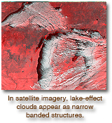
A determination of the presence of global cloudiness is essential to the MODIS mission for two reasons. First, clouds play a critical role in the radiative balance of the Earth and must be accurately described to assess climate. Second, the presence of cloudiness must be accurately determined to properly retrieve many atmospheric and surface parameters. For many of these retrieval algorithms even thin cirrus represents contamination.
Data Set Evolution
The MODIS cloud-mask algorithm employs a battery of spectral tests, of which many were used by heritage algorithms, e.g., AVHRR Processing scheme Over cLoudy Land and Ocean (APOLLO), International Satellite Cloud Climatology Project (ISCCP), CLoud Advanced Very high resolution Radiometer (CLAVR), and Support of Environmental Requirements for Cloud Analysis and Archive (SERCAA) to identify cloudy FOVs. From these a clear-sky confidence level (confident clear, probably clear, probably cloudy, cloudy) is assigned to each FOV. For inconclusive results, spatial- variability tests and/or unambiguous clear-sky tests are applied. The spectral tests rely on radiance (temperature) thresholds in the thermal infrared and reflectance thresholds in the visible and near-infrared. Thresholds vary with surface type and temperature, atmospheric humidity, and viewing geometry. Along with calibrated radiances and geolocation information, a 1-km land/water mask, DEM, ecosystem analysis, snow/ice cover map, NCEP analysis of surface temperature, and an estimate of total column precipitable water are required as inputs.
Cloud mask validation has been conducted using collocated and highly accurate CALIOP (Cloud-Aerosol Lidar with Orthogonal Polarization) data.
Additional Information
Coverage: Global
Spatial/Temporal Characteristics: 250 m and 1 km / daily
Key Science Applications: Cloud determination and screening, climate modeling & monitoring, increasing accuracy of other MODIS retrievals
Key Geophysical Parameters: Presence of cloud
Processing Level: 2
Product Type: Standard, at-launch
Maximum File Size: 100 MB
File Frequency: 288/day
Primary Data Format: HDF-EOS