

The MODIS Aerosol products monitor the ambient aerosol loading and some properties of the aerosol over cloud-free snow/ice-free land and ocean surfaces. Using different spectral and spatial observations provided by MODIS, multiple algorithms are applied to retrieve aerosol properties over diverse surfaces. Data from two different algorithms are provided over land, known as Deep Blue and Dark Target Land. A further Dark Target Ocean algorithm is applied over oceanic and inland waters. The primary data product from all of these is the aerosol optical depth (AOD, also known as aerosol optical thickness, AOT) at a wavelength of 550 nm. In addition, each algorithm provides selected additional information about the aerosol, such as single scattering albedo, spectral AOD, or descriptions of relative aerosol size, as well as quality assurance information.
There are two MODIS Aerosol data product files: MOD04_L2, containing data collected from the Terra platform (2000 onwards); and MYD04_L2, containing data collected from the Aqua platform (2002 onwards). Granule-level (Level 2) data are produced at a horizontal pixel size (at nadir) of 10 km x 10 km. The Dark Target Land and Ocean products are additionally provided at a horizontal pixel size (at nadir) of 3 km x 3 km within the MOD04_3K and MYD04_3K files for Terra and Aqua respectively.
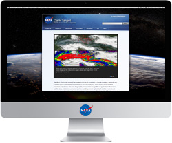
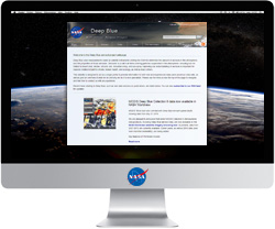
For more information about the Dark Target Land and Ocean algorithms see the Dark Target project webpage (https://darktarget.gsfc.nasa.gov). For more information about Deep Blue see the Deep Blue project webpage (https://deepblue.gsfc.nasa.gov).
Research and Application
Aerosols are highly variable in time and space. Some of the largest uncertainties in climate modelling are due to quantifying their effects on the Earth’s radiation budget. Aerosols have a direct radiative effect (scattering and absorption of solar and thermal energy), as well as indirect/semi-direct effects (influencing cloud development, which leads to changes in the water cycle).
In addition to their effects on climate, aerosols near the Earth’s surface (also often referred to as ‘particulate matter’) are detrimental to human health and visibility. Aerosols such as volcanic ash and mineral dust can also be a hazard to aircraft. MODIS aerosol products are being used for research into all these topics, and more.
Data Set Evolution
Prior to MODIS, satellite-based estimates of aerosol loading were largely limited to over-water scenes due to limited capabilities of earlier instruments. The additional spectral bands available to MODIS enable improved characterization of aerosols over land and ocean, increasing data set coverage and accuracy. The MODIS aerosol products have been extensively validated using highly-accurate observations made by the Aerosol Robotic Network (https://aeronet.gsfc.nasa.gov) and other sources.
Additional Information
Coverage: Global (for daytime, cloud/snow/ice-free)
Spatial/Temporal Characteristics: 10 km for Level 2, additional 3 km for Dark Target land and ocean
Key Science Applications: Aerosol climatology, climate modelling, air quality
Key Geophysical Parameters: : Atmospheric aerosol optical depth (global) and aerosol size distribution (oceans)
Processing Level: 2
Product Type: Standard, at-launch
File Frequency: 144/day
Data Format: HDF