A number of ancillary data files are input into the 06_L2 HDF file. (Information provided by Gala Wind)
Ancillary File List:
-
 NCEP GDAS
 Used by Cloud Top Properties (CT) and Cloud Optical Properties (OD).
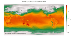
This is a 6-hour forecast / analysis from the GFS model. It is gridded to 1 degree. The code uses two files that bound the granule time in order to temporally interpolate 2D fields used by the retrievals: surface temperature, wind speed, column ozone, surface pressure, mean sea level pressure and relative humidity at 2m altitude. We do not interpolate the 3D fields. The model information is used for atmospheric correction by the OD code and atmospheric transmittance / radiance profiles by both CT and OD codes. The model information is used as a starting point for the retrieval of cloud top properties.
Derber, J. C., D. F. Parrish, and S. J. Lord (1991), The new global operational analysis system at the National Meteorological Center, Weath. Forec., 6, 538-547
-
 NISE Snow and Ice Cover
 Used by both Cloud Top Properties (CT) and Cloud Optical Properties (OD).
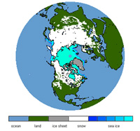
This is a 5-day running average snow and sea ice cover (yes/no for snow and a percentage cover for sea ice) from the SSM/I-SSMIS instrument provided by the NSIDC (National Snow and Ice Data Center). The product is output on a polar grid at 20km resolution. If the granule time is before 12:00 UTC, the NISE product from the previous day is used, otherwise the product from the granule's day is used. The data in this product is used in conjunction with the gap-filled surface albedo product and the 1/10 degree broadband surface emissivity product in order to establish the final value of surface albedo or surface emissivity depending on the spectral channel.
Nolin, A., R. L. Armstrong, and J. Maslanik (1998), Near-Real-Time SSM/I-SSMIS EASE-Grid Daily Global Ice Concentration and Snow Extent. Version 4. [Extent]. Boulder, Colorado USA: NASA DAAC at the National Snow and Ice Data Center. NISE Web Site
-
NCEP Sea Ice
Used by both Cloud Top Properties (CT) and Cloud Optical Properties (OD).
This is a gridded 0.5 degree sea ice fraction product. It contains information that is almost the same as information in the NISE product, so this might be dropped in the future. References for that product are also scanty. It contains a single GRIB record in it which is a global sea ice fraction. It is selected at processing time in the same fashion as the NISE product.
-
Gap-filled Surface Albedo Product
Used by Cloud Optical Properties (OD) only
This is a 1km resolution 8-day average gap-filled spectral surface albedo product. It is needed in order to remove surface contribution from measured reflectance, so that once atmospheric correction is done, only the contribution from the cloud itself remains (in theory).
Sun, Q., Z. Wang, Z. Li, A. Erb, and C. L. B. Schaaf (2017), Evaluation of the global MODIS 30 arc-second spatially and temporally complete snow-free land surface albedo and reflectance anisotropy dataset. Intl. Journal of Applied Earth Observation & Geoinformation, 58, 36-49, doi:10.1016/j.jag.2017.01.011. View PDF
-
 IGBP Ecosystem Map
 Used by Cloud Optical Properties (OD) only
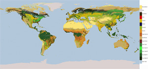
This is a 1-minute resolution gridded ecosystem type map. There are 18 different ecosystem types. The map is used by the OD product in order to correctly select the snow albedo to be used during retrieval if the NISE product indicates presence of ground snow. It is a static product.
-
Global Broadband Land Emissivity Product
Used by both Cloud Top Properties (CT) and Cloud Optical Properties (OD).
This is a 1/10 degree broadband land emissivity product developed by the MODIS Atmosphere Profile (07_L2) team. It is used to remove the surface contribution from measured radiance of channels from 3.7µm onward. It is a static product.
Seemann, S. W., E. E. Borbas, R. O. Knuteson, G. R. Stephenson, H-L. Huang, 2008: Development of a Global Infrared Land Surface Emissivity Database for Application to Clear Sky Sounding Retrievals from Multispectral Satellite Radiance Measurements. J. Appl. Meteor. Climatol., 47, 108-123.
-
PFAAST Transmittance Model Coefficients
Used by both Cloud Top Properties (CT) and Cloud Optical Properties (OD).
The list of files used:
- modisdet.dry.101.big_end
- modisdet.dry.101.lit_end
- modisdet.ozo.101.lit_end
- modisdet.wco.101.lit_end
- modisdet.wtl.101.lit_end
- modisdet.wts.101.lit_endThese coefficients are the precomputed values from the PFAAST transmittance model provided by the University of Wisconsin - Madison. They are used in conjunction with an atmospheric profile of temperature, moisture and ozone in order to arrive at a spectral and vertical profile of atmospheric transmittance at 101 levels. This profile is then used in a number of places: atmospheric correction, CO2 slicing, IR Window retrieval and cloud phase. The cloud top properties code is the primary user of this product, but OD code uses it as well.
-
Reflectance LUTs and Phase Functions
Used by Cloud Optical Properties (OD) only.
These are the core lookup tables used by the OD code in order to actually perform the retrieval of cloud optical thickness and cloud effective radius. Once the surface and atmosphere contribution had been removed from measured reflectance, reflectances in a nonabsorbing channel (such as 0.65 or with 0.86µm) together with an absorbing channel (such as with 1.6 or with 2.1µm) are dropped into the lookup table space and an answer is produced simultaneously for optical thickness and effective radius. There are a lot of references for these lookup tables and the retrieval method. For more information please refer to the Cloud Optical Properties User's Guide.
-
Reynolds Sea Surface Temperature (SST) Product
Used by Cloud Top Properties (CT) only.
This is a weekly Reynolds sea surface temperature gridded product. It is used by the legacy 5km cloud top properties code. This input is superceded by a superior product of surface temperature contained within the NCEP GDAS data that actually captures the diurnal variation of sea surface temperature while using same exact algorithm.
-
Atmospheric Transmittance Table
Used by Cloud Optical Properties (OD) only.
The atmospheric transmittance table is generated using the ECMWF ERA-40 atmospheric profile database screened for cloudy profiles and the MODTRAN code. The individual transmittances from each profile are averaged together into a lookup table of 10 presure levels, 53 column water vapor amounts and 20 angles for each channel of interest. The mean transmittance is used for atmospheric correction of channels shorter than 3.7µm and the standard deviation figures into the pixel-level uncertaintly calculations.

