

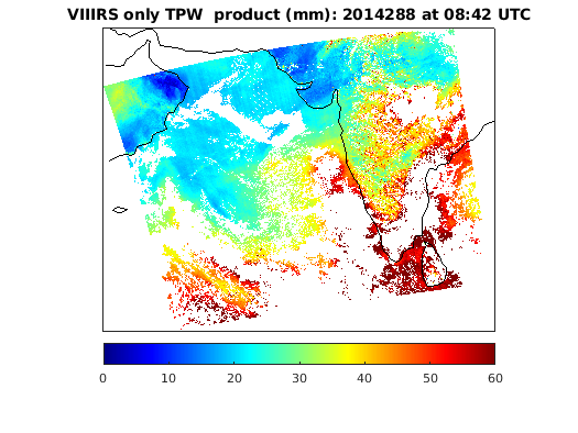
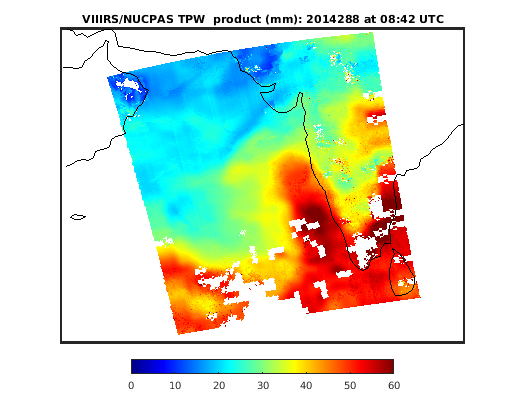
L2 WATVP (Water Vapor) Product Description
The Level-2 Continuity Water Vapor product is generated at 750x750 m (VIIRS, at nadir) spatial resolution. The L2 Continuity Water Vapor data product files always have a prefix of WATVP_L2 and contains data retrieved from the VIIRS instrument on the SNPP platform. The figures below show WATVP_L2 Total Precipitable Water [mm] products derived from VIIRS-only and VIIRS combined with NUCAPS product on 25 October 2014 at 08:42 UTC.
January 2018 Monthly Mean Atmosphere Water Vapor Content. Top is daytime, bottom is nighttime.